Directions and Maps
This page provides directions and maps for the main site the college, as well as its graduate housing complex in Summertown (Robert Saunders House, or RSH) and the sports ground (shared with St. John's College). For more information on the college buildings and facilities on these sites, please visit the facilities page.
Map of the main college site
A site map of the main college site of St. Anne's is provided below (click to enlarge). If you'd like to visit the main college site, you can take a self-guided tour (PDF) of the college.

For more information on the buildings shown on this map, please visit the facilities page.
Location of the main college site
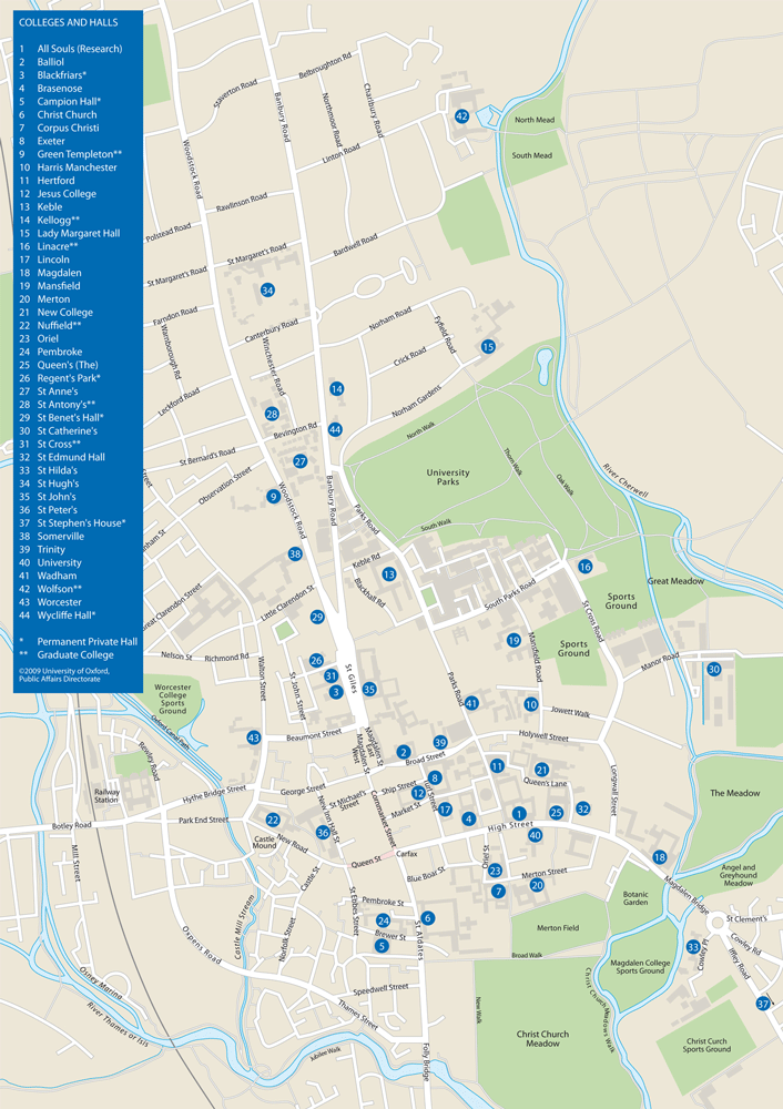
A map of the location of all Oxford colleges as well as the Oxford city centre is shown below (click to enlarge). St. Anne's College is number 27 on the map. You can also download a high-quality copy of this map (PDF).

As shown on the map, St. Anne's sits comfortably between Banbury Road (next to the University Science Park) and Woodstock Road. From the city centre (e.g. Gloucester Green), the main college site is a short walk up St. Giles, which branches into both Banbury and Woodstock Road. The main entrance and college lodge are on Woodstock Road (the left branch from St. Giles).
Robert Saunders House (RSH)
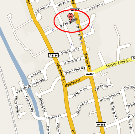
Robert Saunders House is located in Summertown, just off Banbury Road and about 10 minutes cycling north of the main college site. A map of the location is shown below (click to enlarge).

The street address of RSH is 45 South Parade, Oxford OX2 7JL. From the city centre, you can get to RSH by taking bus 2, 2A, 2B, 2C, 2D to South Parade (the second stop in Summertown). Alternatively, going to RSH takes about 15 minutes cycling or 30 minutes walking north along Banbury Road up to South Parade.
Please note that South Parade is a one-way street flowing from Banbury Road to Woodstock. Hence, if you are coming by car or taxi, be sure to take Banbury Road (and not Woodstock Road) so that you will be able to turn into South Parade. Also, there is another street called "North Parade" which, rather confusingly, is actually located further south than the "South Parade" street is. You will pass this street if you're heading to RSH from the city centre; if you see it, don't be surprised and just keep heading further up Banbury Road!
For more information on RSH itself, please visit the accommodation page.
Sports ground
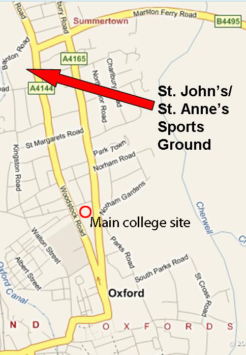
St. Anne's shares a sports ground with St. John's College. A map of the location is shown below (click to enlarge).

The sports ground is located on Woodstock Road at about 6-7 minutes cycling north of the main college site. From RSH, the grounds are due south and are even closer.
For more information on the sports ground, please visit the college sports page.


